The re-excavation
The further excavation between 2019 and 2021 took place ‘in the field’ only at the outset, as the work at the site is referred to in archaeological circles. A significant part of the work took place in the collections of the State Office for Heritage Management and Archaeology, as the remains of the grave pit were recovered as a block and transported there for further analysis. The investigations in the field and on the block itself were carried out by Andreas Siegl.
My name is Andreas Siegl, and I work as an excavation technician at the State Office of Heritage Management and Archaeology. This includes both the preparation and the excavation work, the compiling of documentation up to the submission of the final excavation report.
First and foremost, of course, was the question whether parts of the grave pit or the grave itself had been preserved despite the excavation in 1934. And if so, what information and new insights we can gain about the burial. On the one hand, if parts of the grave pit have been preserved, there is of course the possibility that also finds are still preserved in the ground. Furthermore, the shape, size, and layout of the grave pit provide us with additional information, such as how the burial was conducted.
Normally, pits are indicated by discolouration of the soil. This is how we recognise them. That was not the case here. Therefore, various measurements of soil property parameters were carried out. Not only magnetic properties were measured, but also colour spectral values. The results were then represented visually in illustrations to convey the shape and extent of the grave pit. In addition, imaging techniques such as thermography were also used, supplemented by radiological techniques such as computed tomography.
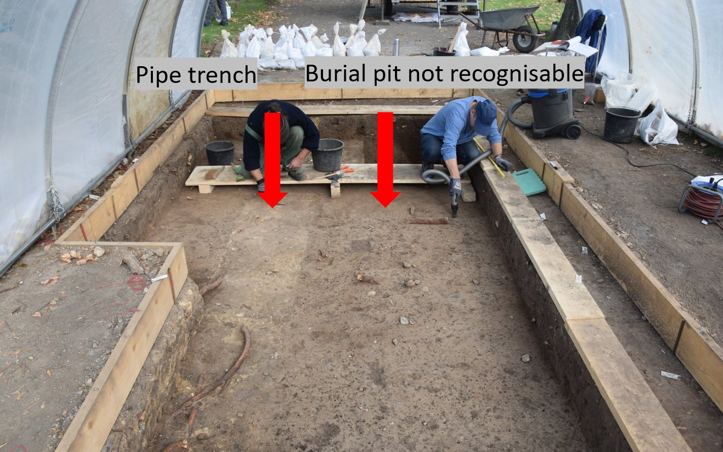
On plane 2, the 1934 utility trench is clearly visible, whereas unfortunately the same cannot be said of the burial pit. © LDA Saxony-Anhalt, photo: Andreas Siegl
If, for example, we assume that digging a pit destroys the natural formation of the soil structure and this can no longer be seen from the discolouration, these differences in soil composition nevertheless remain. For example, when we take a thermographic image, i.e. a thermal image of a previously heated area, we find that different sediments heat up and cool down at different rates depending on their composition. And we then obtain an image of the structures in the soil, but as a false-colour image.
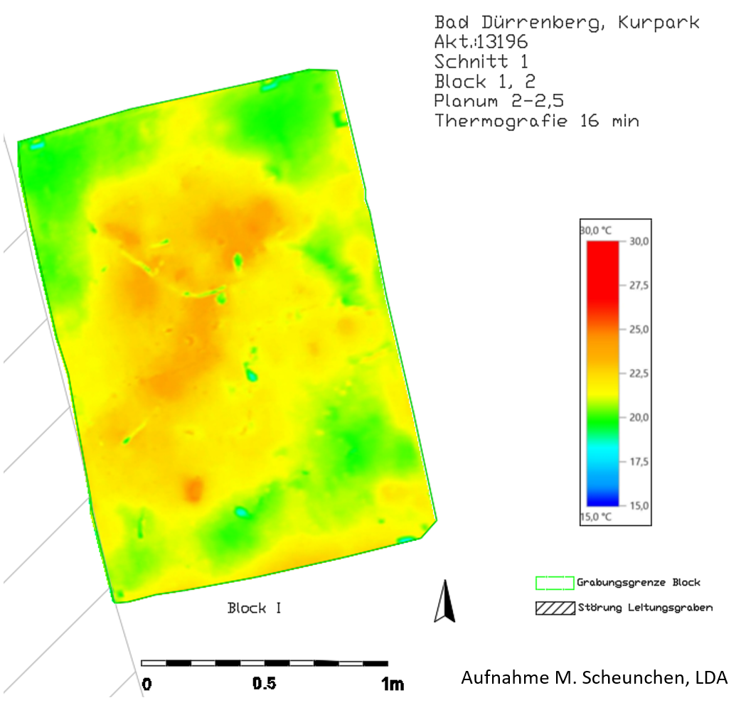
Whilst the block is heated to 27 degrees and than cools down, an image is captured every minute using a thermal imaging camera over a certain period of time. This image shows the 16th minute. The combination of all the images provides clues about different sediments, which cool down at different rates. Image by Merle Scheunchen, compiled by Andreas Siegl. © LDA Saxony-Anhalt
Exciting and, above all, surprising in terms of the results I think was the use of computer tomography, i.e. CT scans, which we performed on sub-blocks of the grave. Compared to purely visual examination of the photos of the surfaces, we gained a considerable amount of new insight because the formation and differences in structure, which ultimately provide us with information about the grave, were much more clearly recognisable than we are used to. What's more, this has provided an opportunity to move through these earthen blocks in several directions without causing any damage, thereby gaining a spatial impression.
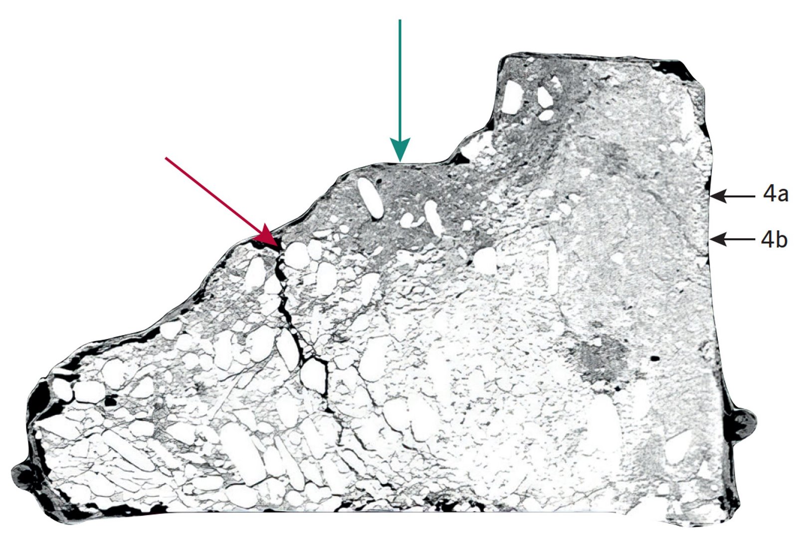
Part of the block excavation was also illustrated using computerised tomography scans to document the interior. The image shows the preserved remains of the grave pit following the removal of the 1934 refilling, appearing as a darker layer over lighter (natural) gravel layers. The intensely dark area (green arrow) marks the position of the outer wattle. A step formed from loose rubble (red arrow) indicates the boundary of the deeper structure. CT scan: Prof. W. A. Wohlgemuth, University Hospital and Polyclinic for Radiology © LDA Saxony-Anhalt, edited by Juliane Fillip
We were indeed able to identify parts of the preserved grave pit, though it was much larger than expected. It consisted of two pits, one above the other, with a so-called installation in the lower one, which was made of wickerwork and had a mineral lining similar to plaster. Within the resulting interior space, the actual burial took place with the bodies and the grave goods. It is interesting to note that the structure documented in 1934 as a grave pit corresponds exactly to this installation in terms of location and shape.